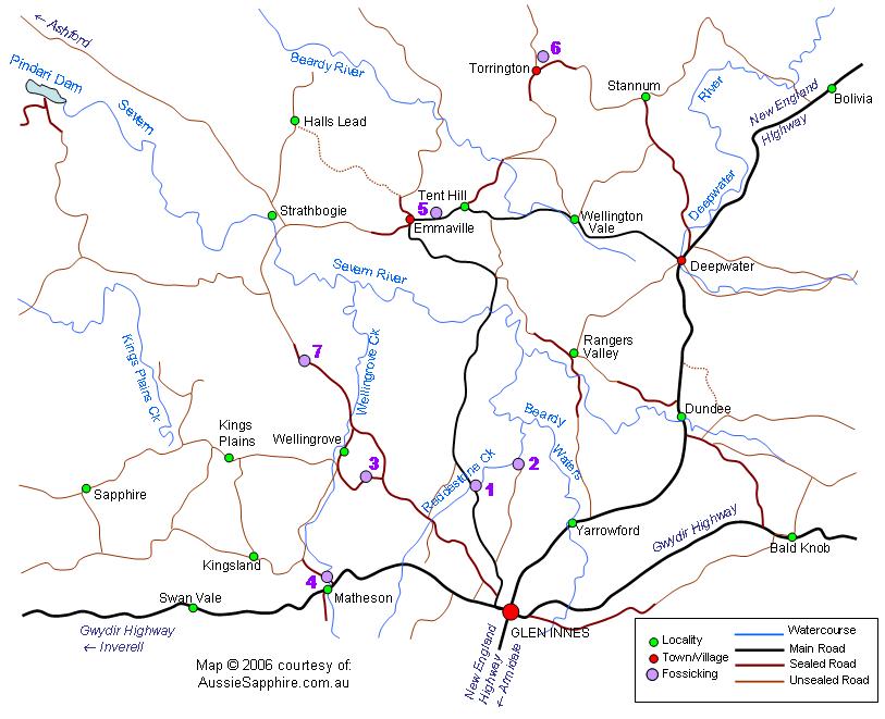
Map - Northwest Glen Innes
Map of fossicking sites Northwest of Glen Innes - click the purple dots for more informationBoolabinda on the Reddestone CreekReddestone Creek bridge on the Emmaville RoadFossicking in the Torrington areaWellingrove Fossicking ReserveWellingrove Creek at MathesonCamerons Creek Bridge on the Strathbogie Road, Glen InnesFossicking in the Emmaville area
  • Click on the purple dots for links to more information about this fossicking area
  • See more information about fossicking in the Glen Innes & Inverell district at our Information Page.
  • This map is printable - set to landscape before printing to fit all of it on one page.